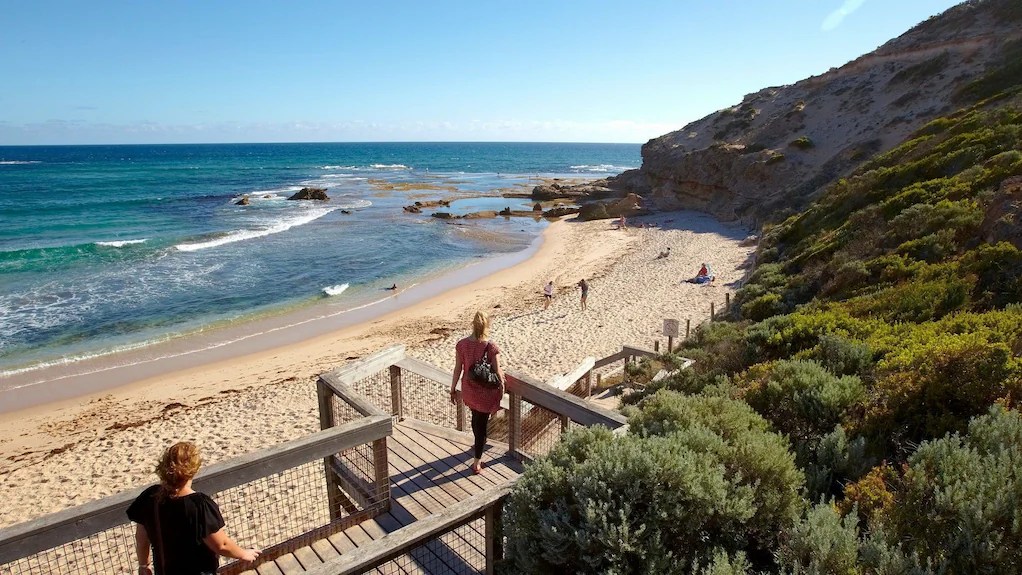
Coastal erosion is our new reality. We need to prepare for changes to our coastal landscape due to rising sea levels. A planned retreat (or managed retreat) involves the purposeful relocation of people, infrastructure, and ecosystems away from the coastline. Victoria is planning for sea level rises of 0.8m by 2100. This is a mandated benchmark to better guide planning decisions.
We should stop trying to sandbag against a rising sea. We need many local debates to understand, community-by-community, how this will impact the environment, local recreation, transport infrastructure, beachside services and private land holdings. Australia has strong social and cultural values related to public access to the coastline, but we need to prepare. Councils preparation and planning is detailed but the public must be brought along the journey too.
Port Phillip Bay serves as the primary testing ground for Victoria’s coastal planning, as it contains over 1.3 million residents and some of the state’s most at-risk infrastructure.
Summarised by Google, prompted by me.
Australian coastal planning has evolved from early colonial land grants to a complex, multi-tiered system focused on climate resilience and Integrated Coastal Zone Management (ICZM). [1, 2, 3, 4]
🏛️ Governance Evolution
Unlike many nations, Australia lacks a national coastal management act. Instead, planning is a patchwork of state-level legislation and local government implementation. [5, 6]
- Early Colonial Period: Focused on land alienation and private development, often ignoring coastal dynamics.
- 1950s–1960s: Major storm events caused massive infrastructure damage, prompting the first formal engineering and protection boards.
- 1970s–1980s: Modern statutory frameworks began to emerge, such as the SA Coast Protection Act 1972 and the NSW Coastal Protection Act 1979.
- 1990s: Shift toward Ecological Sustainable Development (ESD). Queensland introduced the Coastal Protection and Management Act 1995 to provide holistic oversight. [7, 8, 9, 10, 11]
🌊 Major Planning Milestones
| Period [8, 12, 13, 14, 15] | Key Development | Focus Area |
|---|---|---|
| 1972 | SA Coast Protection Board formed | First state-level coastal authority. |
| 1991 | SA Sea-Level-Rise Benchmarks | First Australian planning system to implement IPCC-based SLR policies. |
| 1997 | NSW Coastal Policy | Integrated planning, sustainability, and ecosystem protection. |
| 2009 | Federal Inquiry | A landmark House of Representatives report, “Managing our Coastal Zone in a Changing Climate”, called for national leadership. |
| 2016 | NSW Coastal Management Act | Introduced a “coastal compartment” approach to risk assessment. |
| 2020 | Victorian Marine and Coastal Policy | Integrated land-sea planning to address climate change and population growth. |
🛠️ Contemporary Approaches
Modern planning increasingly relies on spatial data and flexible benchmarks rather than static lines on a map. [16, 17]
- Hazard Mapping: Tools like Digital Earth Australia Coastlines use decades of satellite data to track erosion.
- Planned Retreat: Some jurisdictions are exploring “retreat” policies for properties at high risk of sea-level rise, though these remain politically contentious.
- Integrated Spatial Planning: Victoria’s Marine and Coastal Strategy 2022 is a recent example of coordinating state and local efforts over a 15-year horizon. [18, 19, 20, 21, 22]
🛡️ Key Challenge: While state governments set the policies, local councils often carry the legal and financial burden of managing coastal hazards and infrastructure. [23, 24, 25, 26, 27]
[1] https://www.tandfonline.com
[2] https://www.sciencedirect.com
[3] https://www.sciencedirect.com
[4] https://www.coastalmanagement.com.au
[5] https://www.sciencedirect.com
[6] https://www.sciencedirect.com
[7] https://onlinelibrary.wiley.com
[10] https://www.sciencedirect.com
[11] https://concernedwaterwaysalliance.org
[12] https://www.tandfonline.com
[13] https://www.coastalconference.com
[14] https://www.epa.sa.gov.au
[15] https://www.sciencedirect.com
[16] https://www.researchgate.net
[17] https://infrastructuremagazine.com.au
[18] https://www.sciencedirect.com
[19] https://link.springer.com
[20] https://digital.atlas.gov.au
[21] https://www.watoday.com.au
[22] https://www.greatoceanroadauthority.vic.gov.au
[23] https://www.cabinet.qld.gov.au
[24] https://soe.dcceew.gov.au
[25] https://www.audit.nsw.gov.au
[26] https://www.marineandcoasts.vic.gov.au
Coastal planning in Australia is managed at the state level, resulting in three distinct frameworks for Victoria (VIC), New South Wales (NSW), and Queensland (QLD). While all focus on Integrated Coastal Zone Management (ICZM), they differ significantly in how they mandate sea-level rise (SLR) benchmarks and integrate hazards into land-use law. [1, 2]
🏗️ Comparative Framework Overview
| Feature [1, 3, 4, 5, 6] | Victoria (VIC) | New South Wales (NSW) | Queensland (QLD) |
|---|---|---|---|
| Primary Act | Marine and Coastal Act 2018 | Coastal Management Act 2016 | Coastal Protection and Management Act 1995 |
| Planning Tool | Victorian Planning Provisions (VPP) | Resilience and Hazards SEPP 2021 | State Planning Policy (SPP) |
| SLR Benchmark | Mandatory 0.8m by 2100 | Discretionary (Council-led) | Mandatory 0.8m by 2100 |
| Key Mechanism | Marine Spatial Planning | Coastal Management Programs (CMPs) | Risk-based Hazard Mapping |
🏛️ Victoria: Centralised Control
Victoria uses a “top-down” approach where the state government sets rigid benchmarks that local councils must follow. [7]
- Mandatory Standards: Clause 13.01-2S of the VPP requires planning for a minimum 0.8 metre sea-level rise by 2100.
- Policy Integration: The Marine and Coastal Policy 2020 explicitly integrates land and sea management, focusing on “living shorelines” over hard engineering.
- Traditional Owners: Stronger emphasis on Aboriginal Victorian custodianship and inclusion in management decisions than older frameworks.
🏖️ New South Wales: Regional Flexibility
NSW recently shifted toward a “bottom-up” model, giving local councils the power to determine their own risk profiles.
- Flexible Benchmarks: Unlike VIC and QLD, the NSW government withdrew its state-wide SLR benchmark in 2012. Councils now choose their own figures based on local evidence.
- CMPs: The system revolves around Coastal Management Programs (CMPs), which are long-term strategic plans developed by councils and certified by the Minister.
- Four Coastal Areas: Management is split into specific zones (e.g., Wetlands, Vulnerability, Environment, and Use) with different development controls for each. [8, 9]
☀️ Queensland: Hazard Risk Focus
Queensland’s system is heavily driven by detailed mapping and a risk-based approach to natural hazards. [9, 10]
- The SPP: The State Planning Policy identifies “Natural Hazards, Risk and Resilience” as a state interest. It mandates a 0.8m SLR for 2100.
- Erosion Prone Areas: QLD uses sophisticated Coastal Hazard Mapping to declare “Erosion Prone Areas” where development is strictly limited.
- Industry Integration: Unique to QLD, coastal planning often intersects with major industrial interests, such as ports and resource exploration. [1, 4]
🔄 Key Differences in Practice
- Legal Risk: In Victoria, the mandatory 0.8m benchmark provides a clear legal shield for councils refusing development, whereas in NSW, councils may face more litigation regarding the “reasonableness” of their chosen benchmarks.
- Implementation: Queensland has some of the most comprehensive digital hazard mapping available to the public, facilitating easier developer due diligence.
- Nature-Based Solutions: Both VIC and NSW have recently prioritised “living shorelines” (mangroves, dunes) over sea walls in their latest 2024–2026 policy updates. [8]
[1] https://www.planning.nsw.gov.au
[2] https://www.sciencedirect.com
[3] https://australiancoastalsociety.org.au
[4] https://www.developmentready.com.au
[5] https://australiancoastalsociety.org.au
[6] https://www.planning.nsw.gov.au
[9] https://www.planning.nsw.gov.au
[10] https://content.actuaries.asn.au
Planned retreat (or managed retreat) involves the purposeful movement of people, infrastructure, and ecosystems away from the coastline. In Australia, this is applied through statutory planning, financial incentives, and physical relocation. [1, 2, 3, 4, 5]
🏠 1. Statutory Planning Tools
Governments use land-use regulations to phase out development in high-risk zones without immediate physical removal.
- Time-Limited Consents: Development approvals that expire once the sea reaches a specific distance from the building or a specific year.
- Example: Byron Shire Council has used “planned retreat” since 1988, where certain developments at Belongil Spit are permitted only on the condition they are removed if erosion reaches a trigger point.
- Trigger-Based Policies: Actions are tied to physical environmental changes (e.g., “when the high-water mark is within 20m of the foundation”) rather than dates.
- Back-Zoning: Changing land use from “residential” to “environmental protection” or “public open space” to prevent new builds or major renovations. Lake Macquarie City Council uses Local Adaptation Plans to guide these transitions. [6, 7]
2. Financial & Market Mechanisms
These tools address the economic loss associated with moving away from the shore.
- Voluntary Buy-Backs: The government purchases at-risk properties at market value and converts the land into public buffers.
- Example: The Resilient Homes Fund in Queensland (following 2022 floods) offered voluntary buy-backs for the most severely impacted homes.
- Transferable Development Rights (TDRs): Landowners in “retreat zones” are given “credits” that allow them to build at higher densities in safer, inland “receiving zones.”
- Rolling Easements: A legal agreement where the boundary between public and private land moves inland as the sea rises, preventing the construction of sea walls that would destroy the public beach.
🏗️ 3. Physical Relocation
The actual movement of assets or infrastructure further inland.
- Infrastructure Setbacks: Moving roads, surf clubs, or utilities away from the immediate shore during scheduled upgrades.
- Example: Many Surf Life Saving Clubs (like those in Victoria’s Great Ocean Road region) are now designed to be modular or relocated as part of their long-term adaptation plans.
- Sacrificial Infrastructure: Building “low-value” assets (like wooden boardwalks or car parks) that are intended to be lost or moved, rather than protected with expensive rock walls.
⚖️ Comparison of Retreat vs. Protection
| Strategy [1, 6] | Goal | Practical Application |
|---|---|---|
| Protect | Hold the line | Sea walls, groynes, beach nourishment. |
| Accommodate | Live with water | Raising floor levels, amphibious houses. |
| Retreat | Move away | Buy-backs, setbacks, and land-use changes. |
📍 Current Context: While most Australian states prefer “protect” or “accommodate” due to high property values, retreat is increasingly seen as the only viable long-term solution for low-density or highly exposed communities.
[2] https://research.qut.edu.au
[3] https://www.sciencedirect.com
[4] https://climatejusticeobservatory.com.au
[5] https://nesplandscapes.edu.au
[6] https://www.coastalconference.com
[7] https://www.parliament.nsw.gov.au
This consolidated table brings together the geographic features, their ecological roles, and the specific planning controls used in Victoria, NSW, and Queensland.
🌊 Coastal Features & Planning Framework
| Feature | Geographic Role | Planning Status | Management Tools |
|---|---|---|---|
| Mangroves | Carbon sinks; dissipate wave energy; fish nurseries. | Protected (All States) | Fisheries Acts; Marine Park Zoning; “Living Shorelines” policies. |
| Estuaries | Transition zone; mixing of fresh/salt water. | High Risk (Flooding) | Estuary Management Plans; Catchment Management Authorities. |
| Sand Dunes | Sand reservoir; primary defense against storm surge. | Critical Buffer | Coastal Hazard Overlays; “No-Build” Setbacks; Dune Stabilisation. |
| River Mouth | Sediment outlet; point of dynamic change. | Variable | Entrance Management Policies (e.g., mechanical opening of bars). |
| Intertidal Zone | Land between high and low tide. | Public Land | Crown Land Management; Native Title considerations. |
| Salt Marsh | Biodiversity hotspot; nutrient filtration. | Endangered (Often) | Biodiversity Offsets; EPBC Act (Federal) protection. |
| Headlands | Natural “hard” protection; creates bays. | Fixed Boundary | Visual Amenity controls; Height limits for skyline protection. |
🛠️ Key Regulatory Intersections
- Victorian Planning Provisions (VPP): Uses Environmental Significance Overlays (ESO) to protect mangroves and salt marshes.
- NSW SEPP (Resilience and Hazards): Maps specific “Coastal Wetlands” (mangroves/marshes) where any development requires a rigorous Environmental Impact Statement (EIS).
- QLD State Planning Policy: Identifies “Erosion Prone Areas” based on the dynamic movement of sand dunes and river mouths.
📌 Summary of Controls
- Vegetation: Generally illegal to clear mangroves or dune grasses without a permit in all three states.
- Public Access: Most planning provisions mandate a foreshore buffer (often 30–100m) to ensure the public can access the coast as it shifts inland.
- Infrastructure: New infrastructure at river mouths or estuaries must now demonstrate “hazard resilience” to a 0.8m sea-level rise (in VIC/QLD).
Port Phillip Bay (Nairm) serves as the primary testing ground for Victoria’s coastal planning, as it contains over 1.3 million residents and some of the state’s most at-risk infrastructure. [1]
🗺️ The Two Coastal Compartments
For planning purposes, the Bay is divided at Williamstown into two distinct “coastal compartments” with different physical characteristics and risks: [2]
- West (Pt Lonsdale to Williamstown): Dominated by low-lying marshlands, mudflats, and Ramsar-listed wetlands. It faces the highest risk of permanent inundation of residential and industrial land.
- East (Williamstown to Pt Nepean): Characterised by sandy beaches and rocky cliffs. This area is highly susceptible to rapid erosion (storm bite) and “recession” of the shoreline. [2, 3, 4]
🏛️ Local Planning Controls
Each of the 10 councils surrounding the Bay (e.g., City of Port Phillip, Mornington Peninsula) must apply specific overlays to manage development:
- Environmental Significance Overlay (ESO): Specifically ESO25 (Port Phillip Coastal Area) protects vegetation and landscape quality. It often requires permits for even minor works like fencing to ensure they don’t impact sand movement.
- Land Subject to Inundation Overlay (LSIO): Identifies land at risk of flooding. Planners use the Port Phillip Bay Coastal Hazard Assessment (2024) to set floor levels for new buildings.
- Public Land Managers: Organizations like Parks Victoria and local committees of management oversee the “Foreshore Management Plans” that determine where to place sea walls vs. where to let the beach retreat. [5, 6, 7, 8, 9]
🌊 Application to Key Features
| Feature | Local Example | Management Approach |
|---|---|---|
| Mangroves | Western Shoreline | Protected as part of the Adapt West strategy to buffer against sea-level rise. |
| Sand Dunes | Elwood & Middle Park | Actively managed through beach nourishment (adding sand) and re-vegetation with Coast Banksia. |
| Estuaries | Yarra River Mouth | Focus on “Integrated Water Management” to reduce siltation and protect water quality for the whole Bay. |
| Intertidal Zone | St Kilda / Brighton | Heavily modified by historical sea walls; current policy favors “nature-based” renewals over traditional rock revetments. |
🏗️ Case Study: City of Port Phillip
The City of Port Phillip is currently one of the most proactive councils, advocating for:
- Infrastructure Renewal: Upgrading 100-year-old sea walls that are failing.
- Consistent SLR Baselines: Using the 0.8m–1.2m sea-level rise projections for 2100 to guide all urban design.
- Stormwater Management: Preventing inland flooding caused by “tide-lock” (when high tides prevent storm drains from emptying into the Bay). [10]
[1] https://www.marineandcoasts.vic.gov.au
[2] https://www.marineandcoasts.vic.gov.au
[3] https://portphillipwesternport.rcs.vic.gov.au
[4] https://www.portphillip.vic.gov.au
[5] https://planning-schemes.app.planning.vic.gov.au
[6] https://www.planning.vic.gov.au
[7] https://www.marineandcoasts.vic.gov.au
[8] https://www.marineandcoasts.vic.gov.au


Leave a Reply